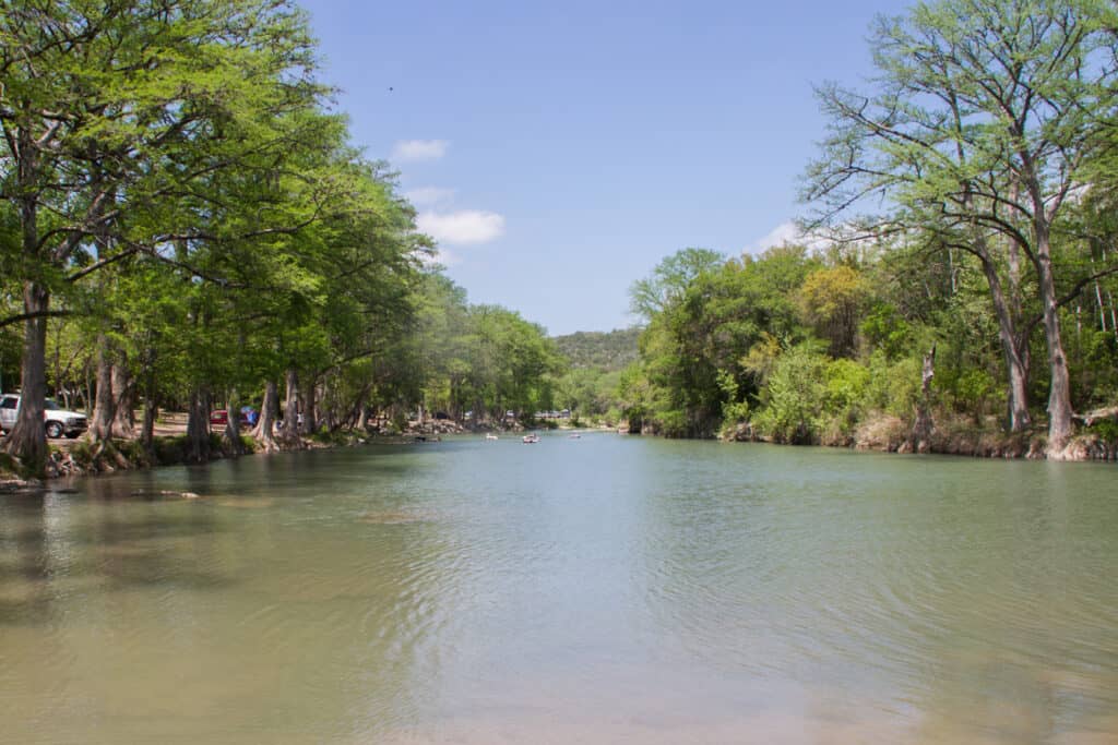
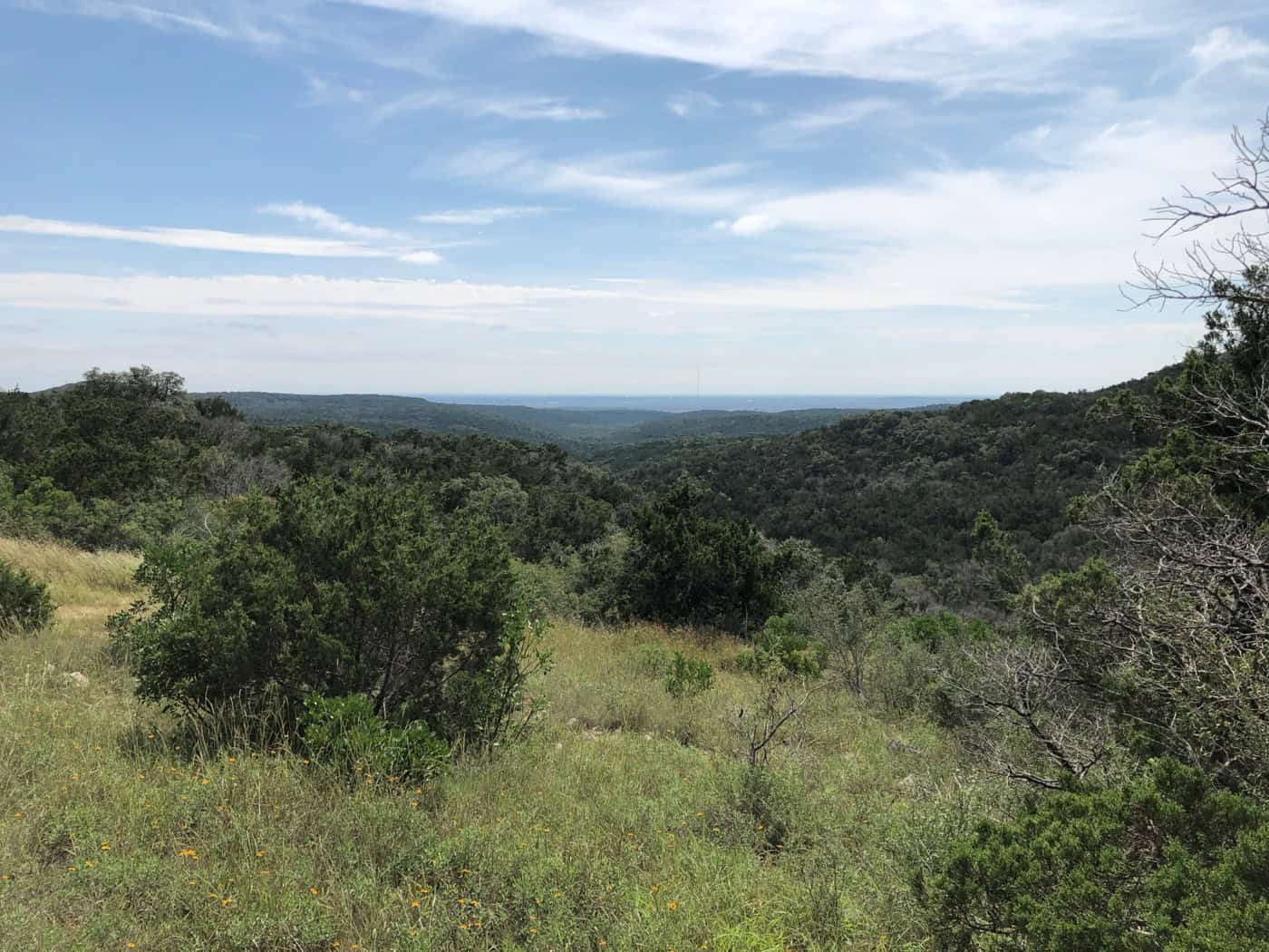
Government Canyon State Natural Area protects about 13,000 acres of canyons and woodland on the northwest edge of San Antonio, in Bexar County, about 40 minutes from downtown. It’s best known for a 5-mile round-trip hike to dinosaur tracks, plus nearly 40 miles of rocky trails for hiking and mountain biking. Trails close after rain and the park often fills, so check trail status and reserve a day pass before driving out.
At a Glance
- Drive time: about 40 min from San Antonio, 2 hrs from Austin
- Entry fee: $6 ages 13+; 12 and under free
- Hours: open daily from 7 a.m.; gates close 8 or 10 p.m.
- Reservations: day pass advised; the park often fills
- Dogs: front-country trails only, 6-foot leash
- Swimming: no swimming or fishing
- Camping: 23 walk-in tent sites, 2 group camps
- Best time: fall to spring; summer is hot
- Closures: hunts Nov. to Jan.; trails close after rain
- Cell signal: TPWD says don’t count on it
- Run by: TPWD, (210) 688-9055
On This Page
- Dinosaur Tracks
- Hiking Trails
- Mountain Biking
- Visitor Center and Discovery Trail
- Camping
- History and the Edwards Aquifer
- Best Time to Visit
- What Visitors Say
- Getting There
- Know Before You Go
- Nearby Parks
- FAQ
- Sources and Official Links
Dinosaur Tracks
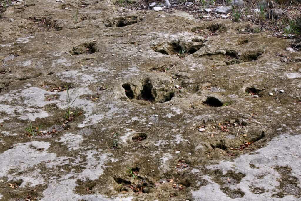
The dinosaur tracks are the main reason many people visit Government Canyon State Natural Area. They sit about 2.5 miles up the Joe Johnston Route, just past trail marker 19, so the hike is about 5 miles round trip. Texas Parks and Wildlife (TPWD) says they are the only known dinosaur footprints on public land in Bexar County.
Scientists think the three-toed prints were left by Acrocanthosaurus, a large meat-eater, and the big round prints by Sauroposeidon, a long-necked plant-eater. TPWD dates them to about 104 million years ago, though its pages give ages from 100 to 110 million.
What the Hike Is Like
TPWD calls the route rocky and rough, with some climbing, and says it is not an easy hike.
- Hikers set out from near the Visitor Center. The Joe Johnston Route follows a wide, rocky old road and is open to hikers and bikes, but not dogs
- Visitors report 1 to 2 hours each way, longer with the Overlook Trail added
- TPWD asks each hiker to carry at least 2 liters of water. There is no water along the trail
- The route passes a signed prehistoric midden (a Native American cooking site) and ends at the 1882 Zizelmann House, 5.7 miles round trip from the trailhead
- The Overlook Trail (1 mile, hiking only) gives a view of the tracks from above, and reviewers often call it the best part of the loop
Seeing the Tracks
The tracks are in a limestone creek bed, so water and mud can cover them. Several reviewers in 2026 found them underwater or hard to make out after rain, while others saw clear prints through shallow water. The prints are roped off, and visitors can view them from a few feet away.
- Guided hike: rangers lead a free “Trek to the Dino Tracks” for ages 10 and up, limited to the first 15 to check in. It meets at 9 a.m. at the Rainwater Tower outside the Visitor Center; dates are on the park events page
- No driving: Google Maps has a separate “Dinosaur Tracks” listing, but no road goes there. Park at the Visitor Center and walk
- Heat: a March 2025 Reddit thread reported 8 heat rescues on this hike in a single month. Start early, even in spring
Hiking Trails
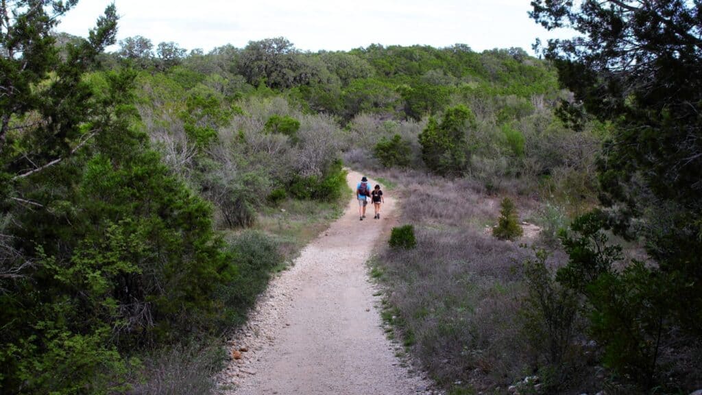
Government Canyon State Natural Area has nearly 40 miles of trails, split into three zones. The Frontcountry trails are flat and open to dogs, the Backcountry trails are rocky and hilly, and the Protected Habitat Area opens only from September through February to protect nesting golden-cheeked warblers.
| Trail | Miles | Open to |
|---|---|---|
| Savannah Loop (Frontcountry) | 2.1 | Hike, bike, dogs |
| Lytle’s Loop (Frontcountry) | 4.7 | Hike, bike, dogs |
| Discovery Trail (stays open after rain) | 1.2 | Hike |
| Bluff Spurs (overlooks) | 1.8 | Hike |
| Overlook Trail (view of the tracks) | 1.0 | Hike |
| Joe Johnston Route (dinosaur tracks) | 4.0 | Hike, bike |
| Sendero Balcones | 4.5 | Hike, bike |
| Far Reaches Trail (Chula Vista and Sotol overlooks) | 3.0 | Hike, bike |
| Twin Oaks Trail | 2.6 | Hike, bike |
| Caroline’s Loop | 2.5 | Hike, bike |
| Wildcat Canyon Trail | 1.6 | Hike, bike |
| Recharge Trail | 1.1 | Hike, bike |
| Little Windmill Trail | 0.6 | Hike, bike |
| Black Hill Loop (Protected Habitat Area) | 4.9 | Hike, Sept. to Feb. |
| Cave Creek Trail (Protected Habitat Area) | 1.7 | Hike, Sept. to Feb. |
| La Subida Trail (Protected Habitat Area) | 0.8 | Hike, Sept. to Feb. |
| Sendero Travesero (Protected Habitat Area) | 0.5 | Hike, Sept. to Feb. |
Miles are one-way segment or loop lengths from the July 2026 TPWD trail map (PDF). Round trips from a trailhead run longer.
Suggested Hikes
TPWD suggests these round trips, with its own times and ratings.
- Savannah Loop: 2.6 miles, 1 to 1.5 hours, easy. Good for dogs and kids
- Lytle’s Loop: 5 miles, 2.5 to 3.5 hours, easy to moderate
- North Bluff Spurs Overlook: 3.4 miles, 1.5 to 2 hours, moderate. A staff favorite
- Joe Johnston Route to the Zizelmann House: 5.7 miles, 3 to 5 hours, moderate to challenging
- Wildcat Canyon and Sendero Balcones: 5.2 miles, 2.5 to 3 hours, challenging
- Far Reaches and Twin Oaks: 9 miles, 4 to 6 hours, challenging
- The Outer Loop: 11.8 miles, 5 to 7 hours, challenging and hard in summer
Trail Tips
Rocky footing is the most common complaint in reviews, and the rain closures catch many visitors out.
- Water: TPWD advises a quart per person per hour; hikers average about 2 miles an hour. Refill at the Visitor Center or campground, since TPWD lists no water on the trails
- Shoes: past the Frontcountry, most trails are loose rock and ledges. Reviewers who wore sandals regretted it
- Rain closures: trails close when wet and muddy and stay closed until they dry; reviewers say this can follow even light rain. The Discovery Trail usually stays open
- Maps: some visitors had trouble finding the trailheads from the parking lots. Pick up a map at the Visitor Center
- Restrooms: reviewers report none along most trails, so use the ones at the Visitor Center before starting
Mountain Biking
Mountain bikes are allowed on most trails at Government Canyon State Natural Area, and riders describe them as rocky, technical and hard. Bikes are not allowed in the Protected Habitat Area or on the Discovery, Overlook and Bluff Spurs trails.
- Bike trails: Savannah Loop, Lytle’s Loop, Joe Johnston Route, Sendero Balcones, Far Reaches, Twin Oaks, Caroline’s Loop, Wildcat Canyon, Recharge and Little Windmill
- Easier riding: the Frontcountry loops and the wide Joe Johnston Route. Some riders use a bike to reach the dinosaur tracks faster
- Harder riding: riders report rock-shelf drops and loose rock on Sendero Balcones and a long, steady climb on Twin Oaks. Some climbs mean walking the bike
- Rules: bikers yield to hikers, and TPWD advises a helmet. Trails close to bikes after rain too
Visitor Center and Discovery Trail
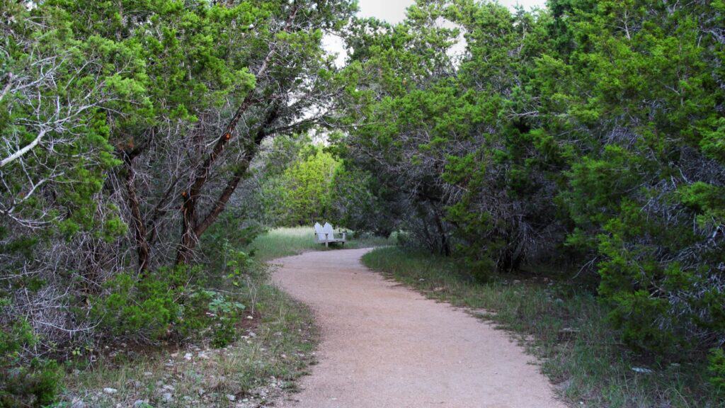
The Visitor Center and the Discovery Trail are the easiest way into Government Canyon, and the best fit for young kids and anyone who can’t manage rocky ground. The Visitor Center is open 8:30 a.m. to 4:30 p.m. and has exhibits on water and native plants, a park store and clean restrooms that reviewers praise.
- Discovery Trail: a 1.2-mile level path of packed granite with boardwalks and benches, starting by the Visitor Center. It usually stays open after rain, when other trails close
- Dogs on the Discovery Trail: TPWD’s pages disagree. The latest trail notice allows them, while the FAQ and trail map list it as no-pets. Ask at the gate
- For kids: Junior Ranger explorer packs to borrow, a fully accessible nature playscape near Parking Lot C and picnic tables around it
- Accessibility: visitors can reserve adaptive devices for the trails (a Grit Freedom Chair, a motorized Trackchair and a TerrainHopper) through the park
Camping
Camping at Government Canyon State Natural Area is walk-in tent camping only. A walk-in site is a tent site a short walk from parking; here it’s 20 to 60 yards from Parking Lot D. There are no hookups, RV sites or cabins.
Campsite Types
Prices are TPWD’s per-night rates, plus the daily entry fee.
- Walk-in tent sites (23 sites, $18): up to 8 people and 2 vehicles each. Every site has a tent pad, picnic table, fire ring with grill, lantern hook and storage hutch. Water spigots sit around the parking lot, and the restrooms nearby have showers. The reservation site lists 22 of these sites online
- Group camps (2 sites, $40): sites 12 and 15, up to 16 people and 4 vehicles each. Book by phone at (512) 389-8920
- Accessible sites: sites 1, 14, 16 and 18 are reached by a hard-packed gravel path and have accessible picnic tables
Reservations and Camp Rules
Camping is open every night of the week, not only weekends as older guides said.
- Campsites open for booking 5 months ahead online; group camps open 12 months ahead by phone
- Check-in is 2 p.m. and check-out is noon
- Campers arriving after the 10 p.m. gate closing call (210) 688-9055 during business hours for the gate code
- Tents stay on the tent pads. No RVs, trailers or pop-ups, and hammocks must be free-standing, not tied to trees
- Fires only in the fire rings, and firewood is sold at the park. Bexar County has had a burn ban since Sept. 15, 2026, so call the park about campfires before bringing wood
Campers describe the sites as roomy, shaded and private. Hauling gear from the car is the main chore, and one camper noted gunfire from a nearby range starting at dawn.
History and the Edwards Aquifer
Government Canyon State Natural Area exists mainly to protect San Antonio’s drinking water. Much of it sits over the Edwards Aquifer Recharge Zone, where cracks and caves in the limestone let rainwater soak into the aquifer, which is why TPWD manages it for conservation first.
- The name: in the early 1850s, Army surveyors under Lt. Col. Joe Johnston laid out a military supply road through the canyon, and locals called it the government road
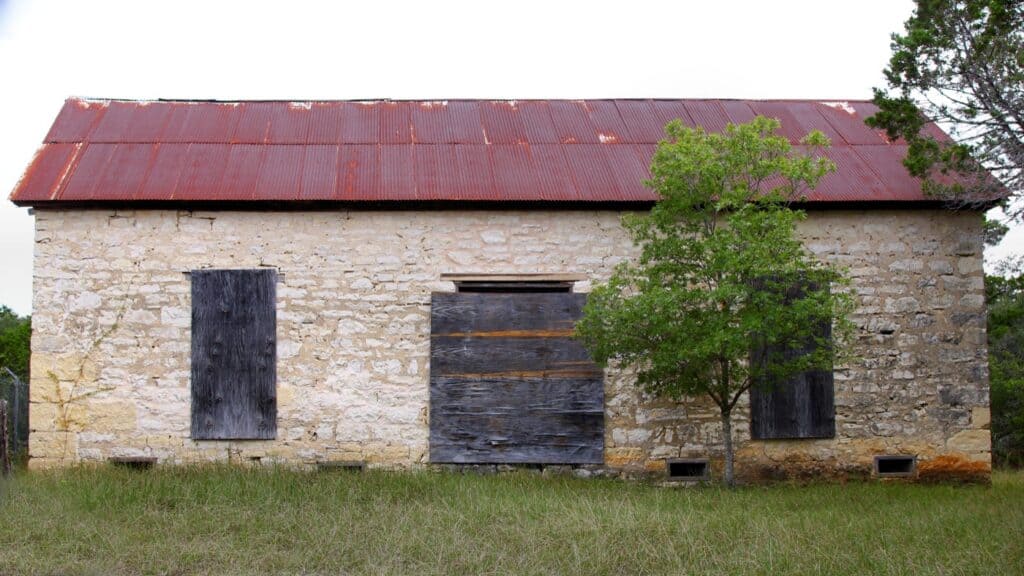
- The Zizelmann House: a German family of bakers built the stone house in 1882. It stands at the end of the Joe Johnston Route, near the tracks
- The park: land purchases began in 1993 with the Edwards Aquifer Authority, the San Antonio Water System, the City of San Antonio, Bexar County and the Trust for Public Land. It opened to the public on Oct. 15, 2005
- Wildlife: the land shelters the endangered golden-cheeked warbler and six of the nine endangered cave invertebrates found in Bexar County
Best Time to Visit
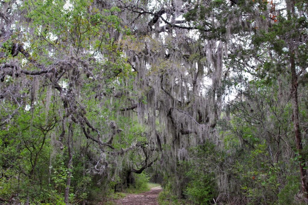
Fall through spring is the best time to visit Government Canyon, when the trails are cooler and, from September to February, the Protected Habitat Area is open. Summer heat makes the long hikes risky, and heat rescues happen even in spring.
- Fall (September to November): the Protected Habitat Area reopens Sept. 1 and the heat eases. Public hunts close the park on set dates from mid-November
- Winter (December to February): every trail is open and the weather is cool for long hikes. Hunts close the park for several days in December and January
- Spring (March to May): wildflowers and nesting golden-cheeked warblers, but the Protected Habitat Area is closed. Weekends are the busiest of the year, so book a day pass
- Summer (June to August): hot, with little breeze in the cedar thickets. Arrive at the 7 a.m. opening and stick to shorter hikes
What Visitors Say
Government Canyon averages 4.8 stars across about 410 Google reviews from November 2024 to October 2026 (4.7 lifetime from about 2,600). Visitors love the tracks and the staff, and the complaints are consistent.
- Dinosaur tracks: the top highlight in about 50 reviews. A handful found them underwater, closed or smaller than expected
- Rocky trails: the most common complaint, with about 30 reviews warning about loose rock and twisted ankles
- Water and heat: “bring more water” is the most repeated tip, in about 30 reviews
- Rain closures: about 9 reviews describe arriving to closed trails after rain, some after only a little
- Weekend entry: waits of 30 minutes or more at the gate on some weekends and holidays, and turn-aways once the park fills. Visitors with a day pass get in faster
- Restrooms and staff: both get steady praise, especially the Visitor Center restrooms and the gate volunteers
- Dogs: several low ratings came from owners who arrived to find dogs banned from the backcountry and the tracks
Getting There
Government Canyon State Natural Area is at 12861 Galm Road, San Antonio, TX 78254, just outside Loop 1604. From Loop 1604, take Culebra Road (FM 471) west about 3.6 miles, turn right on Galm Road, and continue about 3 miles through a roundabout to the entrance. TPWD also gives a route from the Shaenfield Road exit, which becomes Galm Road.
Drive times to the entrance:
- San Antonio (downtown): about 40 minutes
- Austin: about 1 hour 55 minutes
- Houston: about 4 hours
- Dallas: about 5 hours 15 minutes
A few things to know before driving out:
- Traffic: Loop 1604 backs up at rush hour, which can add a lot to the drive from the city
- Gate: one visitor in 2026 reported the gate took cards only. Bring a card, and a printed pass if there is one
- Wrong pin: navigate to the park entrance, not the “Dinosaur Tracks” map listing, which has no road access
- Maps: the parking lots have few signs to the trailheads, so stop at the Visitor Center for a map first
Know Before You Go
Government Canyon is a natural area first, so its rules are stricter than at most state parks. These fees, rules and tips matter most.
- Fees and passes: $6 a day for ages 13 and older; children 12 and under get in free. The Texas State Parks Pass ($70 a year) covers entry. The Texas Parklands Passport gives half-price entry to Texans 65 and older and visitors with permanent disabilities, and free entry to veterans, active-duty military and Gold Star families
- Booking: day passes open 1 month ahead and set an entry time slot, after which visitors can stay all day. TPWD doesn’t require one, but the park often reaches capacity, and leftover passes are sold at the gate only if any remain
- Hours: open daily. Gates are open 7 a.m. to 10 p.m. Friday through Monday and 7 a.m. to 8 p.m. Tuesday through Thursday; the Visitor Center is open 8:30 a.m. to 4:30 p.m. Older guides and reviews describe a Friday-to-Monday schedule that no longer applies
- Rain: trails close when wet and reopen once they dry. TPWD posts trail status on its notices page and Facebook, and staff answer the phone from 7:30 a.m.
- Dogs: allowed on a 6-foot leash on the Frontcountry trails (Savannah Loop and Lytle’s Loop) and at campsites. No dogs in the Backcountry, the Protected Habitat Area, on the tracks hike or in buildings
- Alcohol: public drinking or display of alcohol is not allowed
- Wildlife and pets: visitors reported a rattlesnake and copperheads beside trails in 2026, and ticks on wooded trails. A statewide screwworm alert asks owners to check pets for unusual wounds
- Hunts: the park closes to visitors on set dates for public hunts. For 2026–27: Nov. 16 to 20, Nov. 30 to Dec. 7, Jan. 4 to 8 and Jan. 11 to 15 (from 10 p.m. on the first date to 7 a.m. on the last)
- What to bring: at least 2 liters of water per person for the tracks hike, sturdy closed shoes, sun protection, a paper map and a flashlight for late finishes
Check conditions first: trails close after rain and the park closes for hunts, often with little notice. Check the Government Canyon park alerts and the trail status notice, or call (210) 688-9055 after 7:30 a.m. before driving out.
Nearby Parks
These TrekTexas guides are within about 90 minutes of Government Canyon, with road distances from the entrance.
- McAllister Park: about 25 miles, a large city park with paved and dirt trails and a fenced dog park
- Guadalupe River State Park: about 38 miles, for tubing, paddling and fishing on the Guadalupe River
- Camp Huaco Springs: about 53 miles near New Braunfels, a private campground on the Guadalupe River
- Lost Maples State Natural Area: about 74 miles, famous for bigtooth maples in fall
- Garner State Park: about 84 miles, with floating on the Frio River and 16 miles of trails
- More parks within reach of San Antonio: Parks Near San Antonio
FAQ
Is Government Canyon a state park?
Not quite. It’s a state natural area run by TPWD, managed first to protect the Edwards Aquifer and rare wildlife, which is why trails close when wet and dogs stay out of the backcountry.
Can visitors drive to the dinosaur tracks?
No. The tracks are about 2.5 miles up the Joe Johnston Route, reached on foot or by bike from the trailheads near the Visitor Center.
Is Government Canyon open on weekdays?
Yes. TPWD now lists it as open daily, with gates closing at 8 p.m. Tuesday through Thursday and 10 p.m. the rest of the week.
Can visitors swim or fish at Government Canyon?
No. There are no permanent ponds or streams, and TPWD bans swimming and fishing over the recharge zone. For time on the water, Guadalupe River State Park is about 38 miles away.
Sources and Official Links
Facts in this guide were last checked in October 2026 against these sources.
- Government Canyon State Natural Area (TPWD)
- Entrance fees and campsites (TPWD)
- Trail information and trail map (PDF) (TPWD)
- Park FAQ, history and accessibility (TPWD)
- Park alerts and trail status (TPWD)
- Texas State Parks reservations
- Bexar County Fire Marshal (burn ban)
Featured photo: Chamberlain2007, Wikimedia Commons (CC BY-SA 4.0)
Get More Texas Outdoor Adventure Tips
Subscribe to get more places to explore in the great outdoors of Texas. We’ll never share your email. Unsubscribe any time.