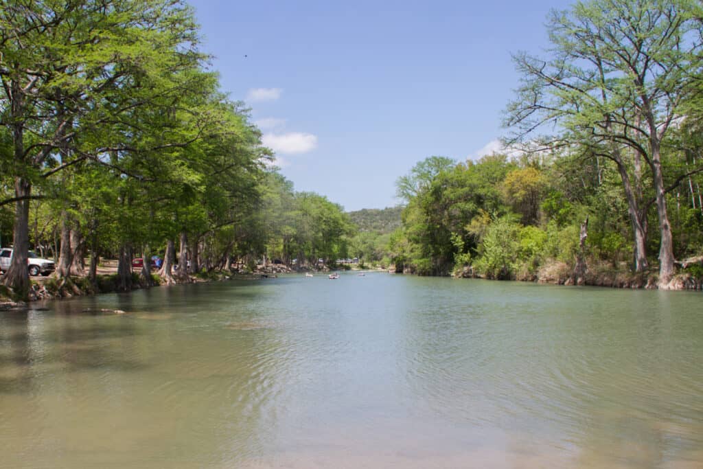
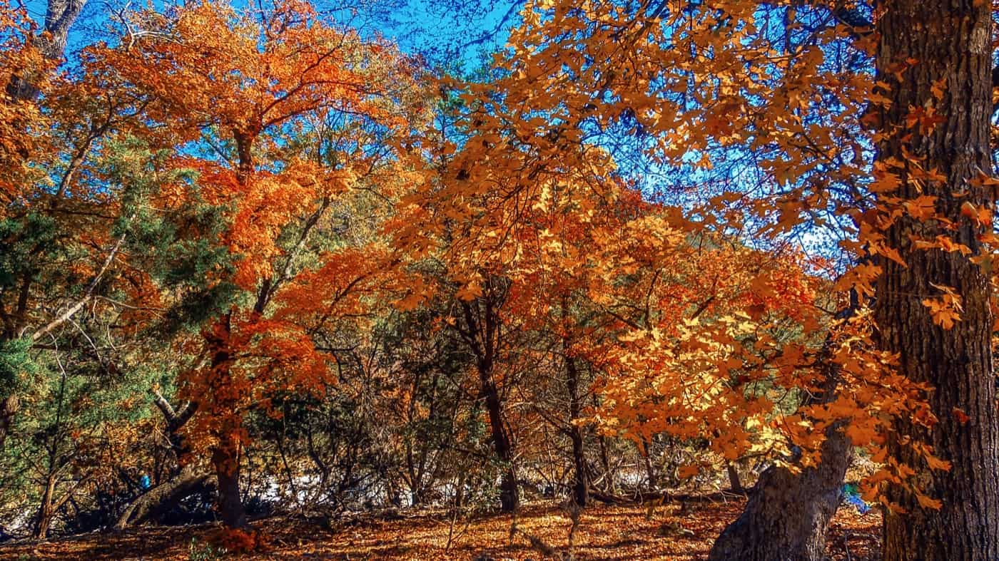
Lost Maples State Natural Area sits in the canyons of the Sabinal River, 5 miles north of Vanderpool in Bandera and Real counties, about 2 hours northwest of San Antonio. It’s best known for fall color from an isolated stand of Uvalde bigtooth maples, which usually peaks sometime between early November and Thanksgiving. Weekend day passes sell out then, so book one before driving out.
At a Glance
- Drive time: about 2 hrs from San Antonio, 3 from Austin
- Entry fee: $6 ages 13 and up; 12 and under free
- Hours: day use until 10 p.m.; office 8:30 to 4:30
- Reservations: day pass required; fall weekends sell out
- Dogs: yes, on a 6-foot leash, trails included
- Swimming: no swim area; wading in pond and creek pools
- Camping: 30 hookup sites, 30 hike-in sites; no cabins
- Best time: early Nov. to Thanksgiving; spring for birds
- Hunt closure: whole park closed Jan. 5 to 7
- Cell signal: none; Wi-Fi at headquarters only
- Run by: TPWD, (830) 966-3413
On This Page
- When to See the Fall Color
- Hiking Trails at Lost Maples
- Camping at Lost Maples
- Water, Fishing and Wildlife
- Stargazing
- Dogs at Lost Maples
- Best Time to Visit
- What Visitors Say
- Getting There
- Know Before You Go
- Nearby Parks
- FAQ
- Sources and Official Links
When to See the Fall Color
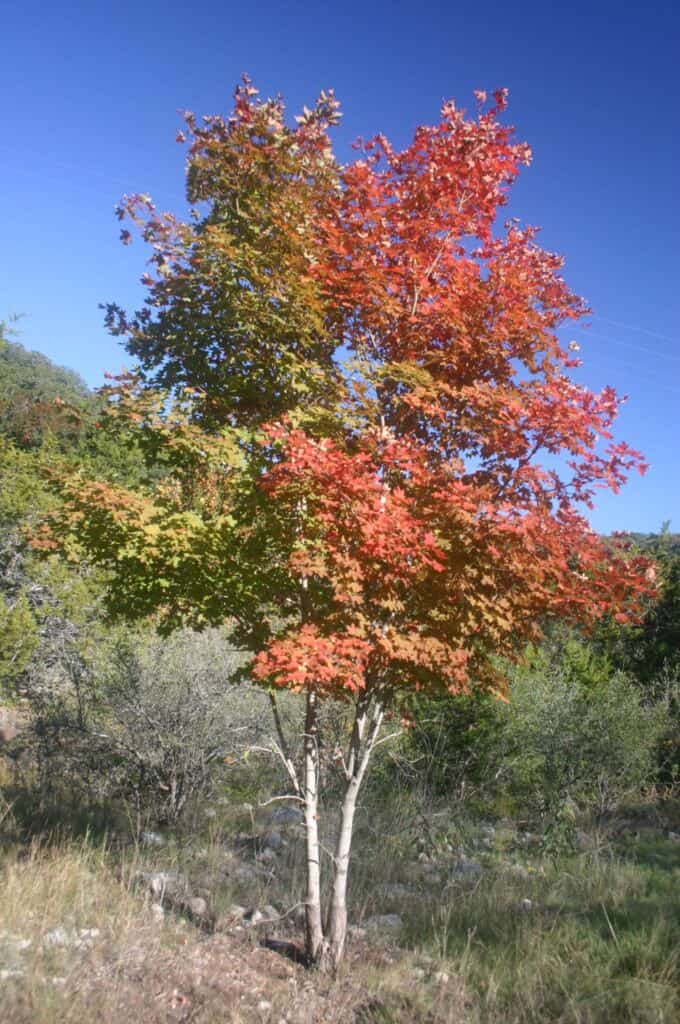
Lost Maples State Natural Area protects an isolated stand of Uvalde bigtooth maples. When the weather cooperates, the leaves turn red, orange and gold along the canyon floors, and sycamores add yellow a few weeks earlier.
Texas Parks and Wildlife (TPWD), which runs the state parks, gives the typical window as the last two weeks of October through the first two weeks of November. Recent seasons have run later than that:
- 2024: little change through mid-November, peak around Nov. 28, leaves falling by Dec. 5
- 2025: green through Oct. 31, color building from Nov. 6, strong but not full color by Nov. 14, trees dropping leaves by Nov. 21
- 2026: the Oct. 21 report found the park still mostly green, with only the edges of a few maples turning
Arriving too early is the most common complaint in reviews from the past two years. A strong cold front usually starts the change, and an early frost can cut the season short. Long-time visitors say peak has shifted from early November toward Thanksgiving.
TPWD posts a fall foliage report from mid-October, updated about weekly through November. The same report plays on the park’s phone line, (830) 966-3413, option 3. The park’s Facebook page posts closures when it fills up.
Fall Crowds and Day Passes
TPWD says the park reaches capacity daily in October and November. Parking holds 250 vehicles, and once the lots are full, the natural area closes to new visitors. In 2025, people were turned away at the gate on fall weekends.
- Book before leaving home: there’s no cell service in the valley, and the Wi-Fi at headquarters is unreliable on busy days. A family that arrived on a December weekday without a pass couldn’t book from the gate and was turned away
- Entry time: check the entry time printed on the pass
- Weekdays: go on a weekday if possible. Crowds bunch at the pond and the first stretch of trail, and the upper trails thin out quickly
- Short on time or energy: TPWD notes that visitors can drive about 1 mile into the park to see foliage from the car
Hiking Trails at Lost Maples
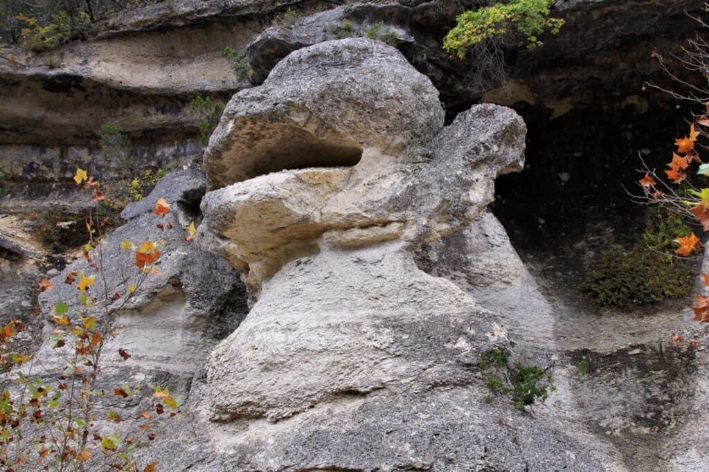
Lost Maples State Natural Area has over 10 miles of trails. The Maple Trail is easy; the East and West trails are steep and rocky, with loose limestone on the descents. Most trails climb out of the canyon on loose rock and rough steps, so sturdy hiking shoes make a big difference.
TPWD lists these distances, one way on its trails page and round trip on the park map, with its hiking times:
| Trail | Miles | Difficulty |
|---|---|---|
| Maple Trail (20 minutes) | 0.4 one way, 0.8 round trip | Easy |
| East-West Trail (45 minutes) | 1 one way | Easy |
| West Loop Trail (about 1.5 hours) | 2.4 to 2.9 (TPWD maps differ) | Moderate |
| East Trail (about 3 hours) | 3.1 one way, 4.6 loop | Challenging |
| West Trail (about 3.5 hours) | 3.6 one way, 4.9 loop | Challenging |
Trail Highlights
Each trail shows a different side of the canyon.
- Maple Trail: the easiest way to see the big stand of maples, and the first stop for most fall visitors
- East Trail: passes Monkey Rock and the Grotto, a shady overhang lined with maidenhair ferns, then climbs to the Scenic Overlook above the Sabinal River valley. The climb is steep and exposed, with little shade near the top
- West Trail: climbs through Mystic Canyon past two springs and joins the West Loop through a grove of Ashe junipers
- Shorter option: hike the East Trail to Monkey Rock and the Grotto and turn around. Reviewers put it at about 4 miles round trip, mostly shaded and mostly flat
Trail Tips
Visitors repeat the same advice.
- Water: carry more water than seems necessary. TPWD suggests 32 ounces per hour of hiking
- Maps: pick up a paper map at headquarters or download the TPWD trail map first. Signs at the upper junctions of the East Trail confuse some hikers
- Bikes: allowed only on the first mile of each trail
- Stay on the trail: off-trail hiking and rock climbing aren’t allowed because the maples have shallow roots
Camping at Lost Maples

Lost Maples has two kinds of camping: drive-up sites with water and electricity, and primitive hike-in sites. Both book up early for October and November.
Campsite Types
Prices are per night, plus entry fees.
- Drive-up with water and electricity (30 sites, $20): water and 30-amp electric hookups. Each has a picnic table, fire ring and shade shelter; up to 8 people and two vehicles per site. Back-in parking pads run from 25 to 67 feet; most are 54 to 63 feet. Sites 30, 17 and 16 are the shortest. Restrooms with hot showers nearby and a dump station
- Primitive hike-in (30 sites, $10): up to 6 people per site. Sites sit in areas A through H, 1 to 3.2 miles from the trailhead on steep, rough trails. Area C doesn’t appear in online booking. Composting toilets on the trail system
A primitive site is a campsite with no water, electricity or restrooms, reached on foot. The park has no cabins, screened shelters or group sites.
Reservations and Camp Rules
Campsites can be reserved up to 5 months ahead, and fall weekends often go the day they open.
- Reserved campers go straight to their site and check in at headquarters by 9 a.m. the next morning
- Quiet hours run 10 p.m. to 6 a.m.
- No campfires at primitive sites; small fuel stoves only. Pack out all trash
- Hike-in sites are often easier to get than the drive-up sites in busy seasons
Campers say the drive-up sites sit close together, with little shade, and that big rigs have trouble around the boulders lining the loop.
Water, Fishing and Wildlife
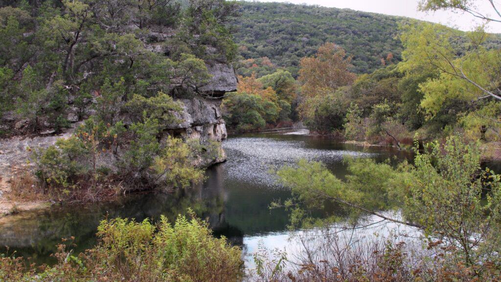
The Sabinal River and Can Creek run through Lost Maples State Natural Area, but they’re shallow and often low. Reviewers found them nearly dry in summer 2026 and flowing well after the wet summer of 2025. TPWD says the river is too shallow for kayaking or tubing.
- Swimming: not a listed activity, and there’s no designated swim area or lifeguard. Visitors and their dogs cool off at the pond and in creek pools when there’s water. For a real swimming trip, Garner State Park and the Frio River are about 30 miles away
- Fishing: no fishing license is needed to fish from the bank in the park. TPWD stocks trout and catfish in the pond at the Pond Day-use Area, which also holds bass, and the park loans fishing gear
- Birds: golden-cheeked warblers, an endangered species, and black-capped vireos nest here in spring and early summer. Green kingfishers are around all year
- Other wildlife: white-tailed deer, gray foxes, bobcats, armadillos, raccoons, rock squirrels and javelinas. Reviewers have seen rattlesnakes in spring, and crows raid unattended coolers at campsites
Flash floods are common in the canyon. Don’t cross a swollen creek, and check the park’s alerts after heavy rain.
Stargazing
Lost Maples has a Bortle 3 dark-sky rating, which means very little light pollution, and TPWD runs a real-time sky monitor on its stargazing page. Campers rate the night sky as highly as the maples. Star parties appear on the park’s events calendar when scheduled.
Dogs at Lost Maples

Dogs are welcome on the trails, in the campground and at primitive sites at Lost Maples. They must stay on a leash no longer than 6 feet and aren’t allowed in buildings. Reviewers say dogs enjoy the creeks and the pond. The rocky descents are hard on small dogs, and many owners end up carrying them.
TPWD posted a screwworm alert in June 2026. Check pets often for unusual wounds, and call a vet or the Texas Animal Health Commission at (800) 550-8242 if anything looks wrong.
Best Time to Visit
Fall is the main season at Lost Maples State Natural Area, for the maple color, and also the most crowded. The rest of the year it’s a quiet Hill Country park with rocky trails, spring-fed creeks and very dark night skies.
- Fall (October to November): color usually peaks between early November and Thanksgiving, and the park reaches capacity daily. Check the foliage report before picking a date
- Spring (March to May): the maples leaf out, the creeks usually carry more water, songbirds arrive, and the trails are far less crowded
- Summer (June to August): July averages a high of 94°F, and the creeks ran nearly dry in summer 2026. The climbs have little shade
- Winter (December to February): January averages a low of 31°F, and weekdays are quiet. The park closes to other visitors for a public hunt Jan. 5 to 7
What Visitors Say

Lost Maples averages 4.8 stars from more than 2,700 Google reviews. TrekTexas read 400 Google reviews from November 2024 to October 2026, plus Tripadvisor, The Dyrt and Reddit threads from the same period. The same themes come up again and again.
- Timing the color: the hard part. Visitors who hit peak color rave about it; those who came in late October often found green trees
- Trails: tougher than expected, with rocky climbs, loose descents and no switchbacks. Most say the overlook is worth it
- Restrooms: the campground bathhouse is clean, with hot showers. Day-use restrooms and portable toilets can run short of paper and soap on busy days
- No cell service: some see that as a bonus; it’s also why visitors need a day pass booked before they arrive
- Staff: mostly friendly and helpful, though a few reviews describe rushed check-ins on the busiest weekends
- Supplies: it’s far from supplies. A small store and barbecue sit just outside the park; otherwise stores are few and far between. Bring food and supplies
Getting There
Lost Maples State Natural Area is at 37221 F.M. 187, 5 miles north of Vanderpool. From San Antonio, TPWD’s directions take Highway 16 north to Medina and FM 337 to Vanderpool, then Ranch Road 187 north for 5 miles. The other route follows US 90 west to Sabinal, then 187 north through Utopia.
Drive times to the park:
- San Antonio: about 88 miles, about 2 hours
- Kerrville: about 52 miles, about 1 hour
- Austin: about 146 miles, about 3 hours
- Houston: about 284 miles, about 5 hours
- Dallas: about 340 miles, about 6.5 hours
A few things to know before driving out:
- Roads: the roads near the park are steep and winding, so allow extra time
- Signal: the signal drops for miles around the park. Download directions and the trail map before the drive
Know Before You Go
Lost Maples State Natural Area is rocky, remote and short on shade. These rules and tips matter most.
- Fees and passes: $6 a day for visitors 13 and older; children 12 and under get in free. The Texas State Parks Pass ($70 a year) covers the holder and guests
- Booking: day passes open 1 month ahead, and every fall weekend needs one because the park closes when its 250 parking spaces fill. Campsites open 5 months ahead. Book online or at (512) 389-8900
- Hours: day passes are valid until 10 p.m. unless the park closes earlier; headquarters is open 8:30 a.m. to 4:30 p.m.
- Dogs: allowed on a 6-foot leash, including trails
- Water and shade: a bottle filler near the parking-lot restrooms and water at the campground. No drinking water on the trails, and little shade on the climbs
- Difficulty: easy on the Maple Trail; steep and rocky on the East and West trails
- Closures: TPWD’s alerts list a public hunt that closes the park to other visitors Jan. 5 to 7. Trails can close after heavy rain; check the alerts and the park’s Facebook page before going
- Cell service: none in the park; Wi-Fi at headquarters only
- Leave No Trace: stay on the trails and pack out all trash
Check conditions first: the park closes when its parking fills, for the January hunt and on trails after heavy rain. Check the Lost Maples park alerts page or call (830) 966-3413 before driving out.
Nearby Parks
Two other TrekTexas guides are within about 75 miles of Lost Maples State Natural Area.
- Garner State Park: about 30 miles away on the Frio River, for swimming and tubing
- South Llano River State Park: about 73 miles away
- More parks within reach of San Antonio: parks near San Antonio
FAQ
Is Lost Maples a state park or a national park?
It’s a state natural area, part of the Texas State Parks system run by TPWD. It isn’t a national park, and the entry fees and reservations work the same way as at other Texas state parks.
Why is it called Lost Maples?
The name refers to the park’s isolated stand of Uvalde bigtooth maples, the trees behind the park’s famous fall color.
Is Lost Maples worth visiting outside of fall?
Yes, for hikers who want quiet trails. Spring brings fresh green canyons, flowing creeks and nesting songbirds, and weekdays outside October and November rarely fill up.
Sources and Official Links
Facts in this guide were last checked in October 2026 against these sources.
- Lost Maples State Natural Area (TPWD)
- Entrance fees and campsites (TPWD)
- Trail list and park map (PDF) (TPWD)
- Fall foliage reports (TPWD)
- Stargazing (TPWD)
- Park alerts (TPWD)
- Texas State Parks reservations
Featured photo: G. Lamar, Wikimedia Commons (CC BY 2.0)
Get More Texas Outdoor Adventure Tips
Subscribe to get more places to explore in the great outdoors of Texas. We’ll never share your email. Unsubscribe any time.