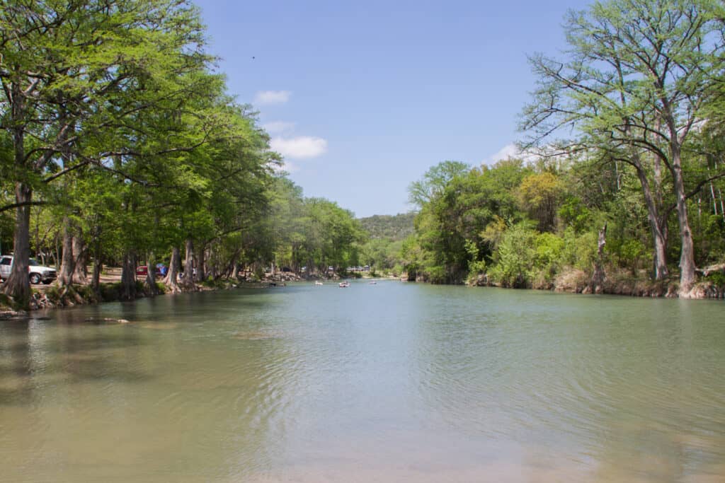
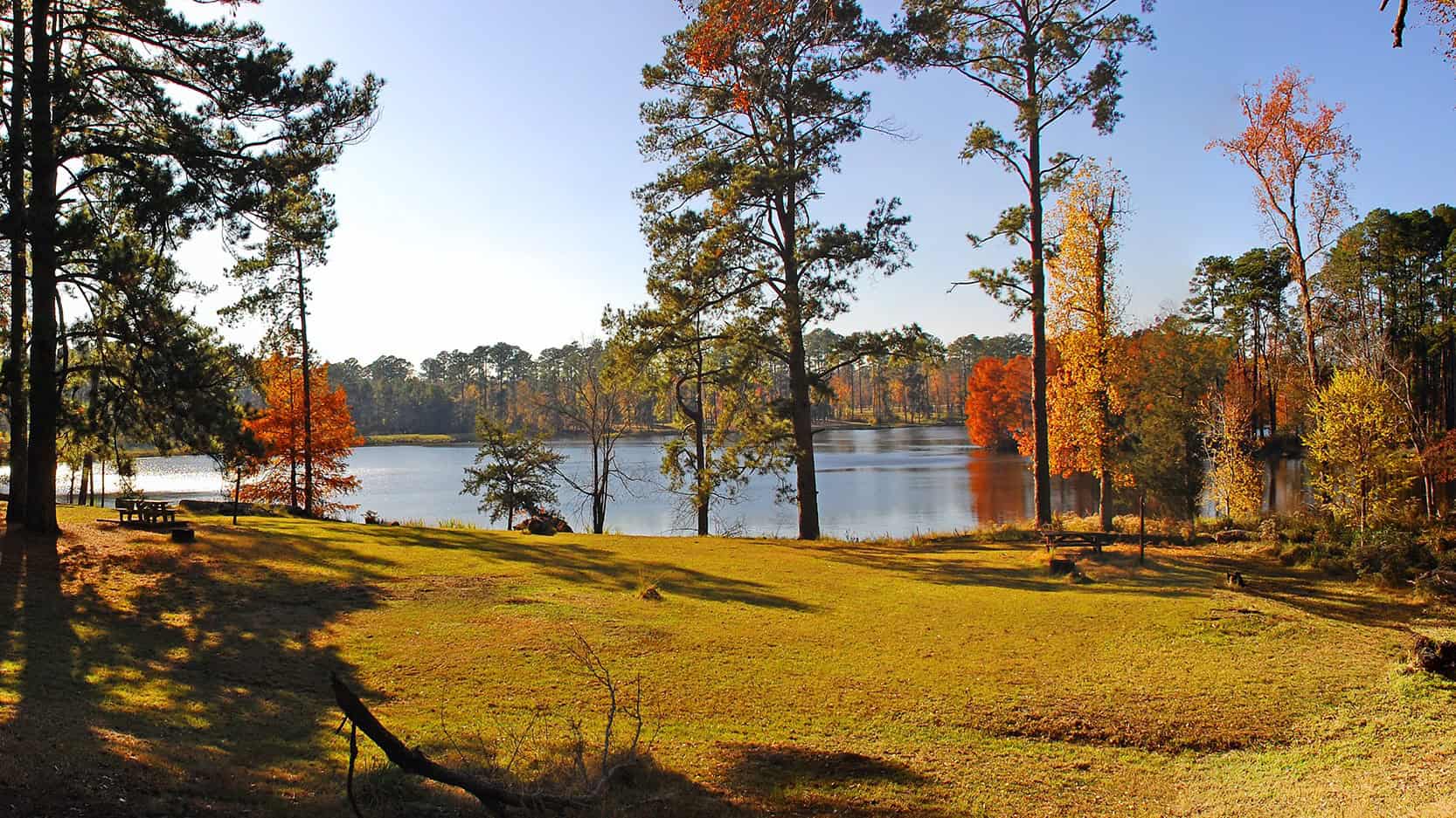
Davy Crockett National Forest covers more than 160,000 acres of East Texas pine and hardwood forest in Houston and Trinity counties, near Crockett and Kennard, about 2 hours 50 minutes northeast of Houston. It’s a national forest run by the USDA Forest Service, not a national park. Most visitors come to camp and swim at Ratcliff Lake or hike the 20-mile 4C Trail, part of which has been impassable since July 2025.
At a Glance
- Drive time: about 2¾ hrs from Houston, 3¼ from Dallas
- Entry fee: forest free; Ratcliff Lake $5 per vehicle
- Reservations: Ratcliff sites on Recreation.gov; no day pass
- Dogs: yes, on a 6-foot leash; not in swim area
- Swimming: Ratcliff Lake swim area; no lifeguard
- Camping: Ratcliff Lake, Neches Bluff, dispersed sites
- Best time: late October to April
- 4C Trail: Big Slough section impassable since July 2025
- Deer season: November 7, 2026 to January 3, 2027
- Cell signal: weak at Ratcliff Lake, per reviews
- Run by: USDA Forest Service, (936) 655-2299
On This Page
- Ratcliff Lake
- Hiking Trails
- Camping
- Hunting
- Big Slough Wilderness and Neches Bluff
- Wildlife and Birding
- Best Time to Visit
- What Visitors Say
- Getting There
- Know Before You Go
- Nearby Parks
- FAQ
- Sources and Official Links
Ratcliff Lake
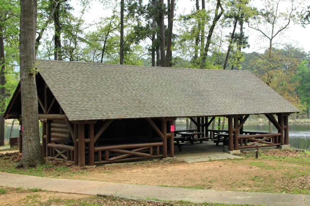
Ratcliff Lake Recreation Area is the developed center of Davy Crockett National Forest, a 45-acre lake where the Civilian Conservation Corps built a recreation area in 1936, and it has the forest’s only swim area, developed campground and hot showers. Day use costs $5 per vehicle. It’s best for a family swim and picnic, pier fishing for bass and catfish, and paddling on a lake limited to electric motors. The TrekTexas guide to Ratcliff Lake Recreation Area covers the swim area, fishing piers, group shelters and campground loops in full.
Hiking Trails
The best-known hike in Davy Crockett National Forest is the Four C National Recreation Trail (the 4C), 20 miles one way from Ratcliff Lake to the Neches Bluff Overlook. Shorter loops start at Ratcliff Lake. Read the Forest Service trail notices before any 4C hike.
| Trail | Miles | Starts at |
|---|---|---|
| 4C National Recreation Trail (no water on trail) | 20 one way | Ratcliff Lake or Neches Bluff |
| Tall Pines Trail | 1.5 | Ratcliff Lake |
| Trail Tamers Trail | 0.75 | Ratcliff Lake |
| Lakeshore Trail (around the lake) | Not listed | Ratcliff Lake |
| Piney Creek Horse Trail (horses, $10 a day) | About 53 | Piney Creek or White Rock horse camps |
Miles as the Forest Service and Recreation.gov list them.
The 4C Trail
The 4C takes its name from the Central Coal and Coke Company and follows some of its old logging tramways through forest that grew back after logging ended in the early 1920s. White rectangular tags on trees mark the route. All of it is national forest land except a 1-mile stretch through private timberland.
- Closures: the Forest Service calls the Big Slough Wilderness section impassable from flood damage and strongly recommends avoiding it. Bridges at mile markers 1.7, 2.07, 2.70, 3.40, 3.98 and 15.00 are no longer safe to cross. Both notices date from July 2025 and had no end date in October 2026
- Water: there is none on the trail. A January 2026 thru-hiker carried 6 liters for two days, and in September 2026 a hiker who ran short needed an emergency rescue near Walnut Creek
- Campsites: the Forest Service trail map shows three: Pond Camp, Walnut Creek Camp and Neches Bluff Overlook Camp. Hikers report a shelter at Walnut Creek, around mile 11.5
- Conditions: hikers in 2026 reported many downed trees, broken boardwalks and stretches rooted up by feral hogs. The tags themselves were easy to follow
Short Hikes at Ratcliff Lake
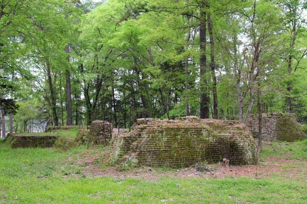
Visitors call the Tall Pines and Lakeshore trails well kept, and one hiker linked them with part of the 4C into a loop of about 5 miles. Brick ruins of the old Four C sawmill sit near the Sawmill Loop. Expect mud after rain.
Camping
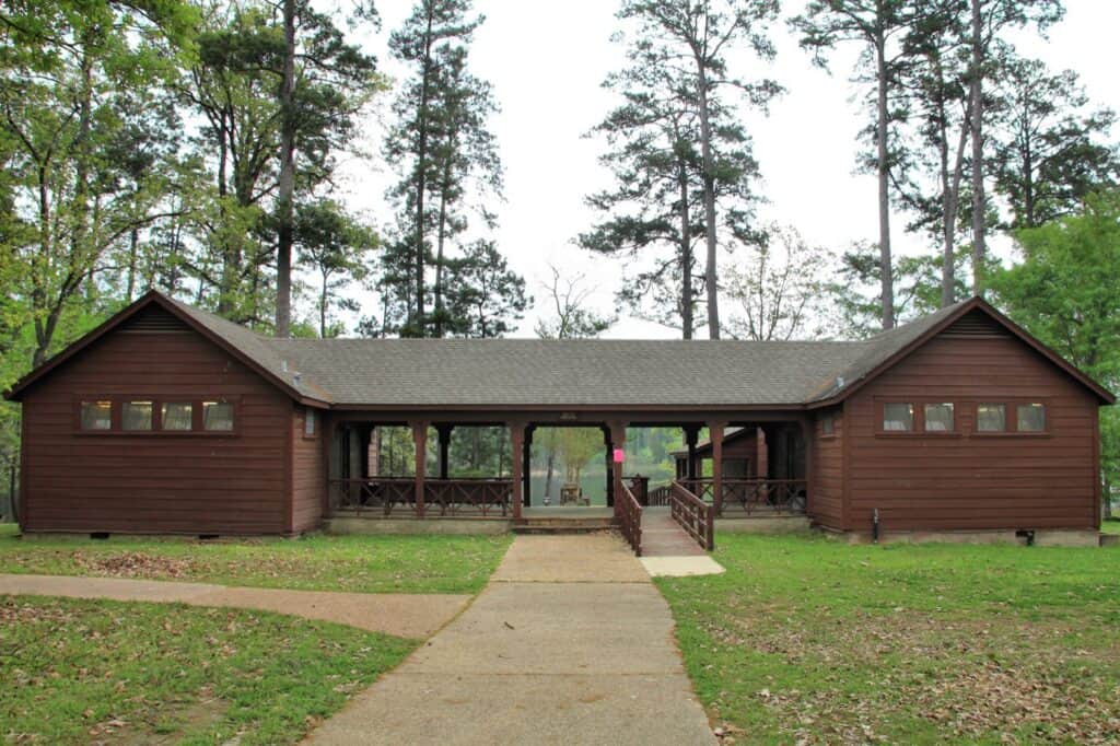
Davy Crockett National Forest has one developed campground, at Ratcliff Lake, plus free primitive camping at Neches Bluff, two horse camps and dispersed camping along forest roads. Primitive means no hookups, drinking water or showers. There are no cabins anywhere in the forest.
Campsite Types
- Ratcliff Lake, Dogwood Loop (25 sites, $20): 30-amp electric hookups and room for rigs up to 50 feet. Recreation.gov lists water hookups at 13 of the 25 sites. No sewer hookups; a dump station is on site
- Ratcliff Lake tent sites (27 sites, $15): the Lakeside (Lakeshore), Loblolly and Sawmill loops plus 2 sites on Forest Service Road 520, all non-electric and tent-only
- Ratcliff Lake group sites (3, $30 a day): one group tent area in each of the Lakeside, Loblolly and Sawmill loops. The Forest Service allows 20 people and three vehicles; Recreation.gov lists 10 people
- Neches Bluff Overlook (free): primitive camping at the north end of the 4C, first come, first served, with a vault toilet and no drinking water. Visitors fit small RVs of about 21 feet
- Horse camps ($10 a day): Piney Creek Horse Camp and White Rock Horse Camp, with vault toilets and trash cans. White Rock has no drinking water
- Dispersed camping (free): allowed within 150 feet of roads marked for it on the Motor Vehicle Use Map. Some of those roads allow camping year-round, others only in fall and winter
Ratcliff Lake sites come with a picnic table and grill. Bathhouses with flush toilets and hot showers sit in the Dogwood and Loblolly loops and the day-use area, and the Forest Service lists two accessible bathrooms with showers.
Reservations and Camp Rules
- Booking: Ratcliff Lake sites book on Recreation.gov or at 1-877-444-6777. On October 30, 2026, 30 sites were reservable and 22 were first come, first served, and bookings ran about 6 months out
- Check-in: 2 p.m.; check-out noon; 14 nights at most
- Site limits: one RV or two tents, two vehicles and eight people per site. Extra vehicles pay $5 a day
- Forest-wide: stays are limited to 14 days in any 30. No camping within 300 feet of a developed parking area or boat ramp, and no gas generators from 10 p.m. to 6 a.m. outside designated areas
- Firewood: buy it at or near the campground rather than bringing it from home
Hunting
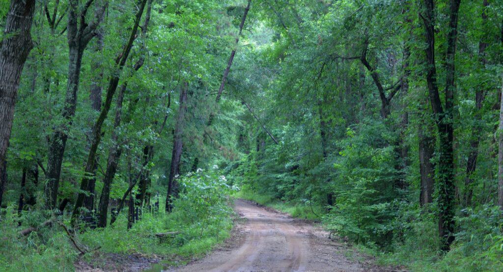
Davy Crockett National Forest is open to public hunting. The general forest needs only a Texas hunting license. The Alabama Creek Wildlife Management Area (WMA), 14,561 acres in Trinity County run by Texas Parks and Wildlife (TPWD), also needs the Annual Public Hunting Permit.
- Deer seasons 2026–27: archery October 3 to November 6, 2026; early youth October 30 to November 1; general November 7, 2026 to January 3, 2027; late youth January 4 to 17, 2027
- Antlerless deer: none in the general forest during the general season. In WMAs, only with a WMA permit
- Hunter orange: required during firearm seasons: 400 square inches, at least 144 on both chest and back, plus orange headwear
- Stands: portable only, removed after 72 hours, never nailed or screwed into trees, and tagged with the owner’s name when left
- Baiting: not allowed. Buckshot is legal in the general forest; WMAs allow slugs only
- Shooting: never from, into or across roads, trails, campsites, parking areas or boat ramps. Target shooting needs a safe backstop and is banned in WMAs
- Other game: squirrel, quail, dove, turkey and waterfowl
Hikers and campers share the woods with hunters from October through January, so bright clothing helps. Check the Forest Service hunting page and the Alabama Creek WMA page for current dates and rules.
Big Slough Wilderness and Neches Bluff
Big Slough Wilderness is the smallest wilderness in Texas: 3,639 acres along the Neches River, per the Forest Service (the 1984 law that created it said about 3,000). Its bottomland forest is about two-thirds hardwoods, with shortleaf and loblolly pine. The 4C crosses about 2 miles of its southern end.
- Rules: hiking, horseback riding, hunting and fishing are allowed. Bicycles, motor vehicles and removing plants, moss, stone or artifacts are not
- Access: the 4C section through the wilderness is impassable. By car, the Forest Service route from Crockett is Highway 7 east 22 miles, then Forest Service Road 511 north 8 miles
- Neches Bluff Overlook: the north trailhead of the 4C looks out over pine and hardwood forest in the Neches River bottomlands. It has picnic sites, primitive camping and a vault toilet, with no water and no fee
- Getting to the overlook: from Crockett, take Highway 21 east 26 miles, turn right on Forest Service Road 511 for half a mile, then left on 511-A
Visitors rate the bluff’s sunrise and sunset views highly. Expect only a handful of spots, rough dirt roads, and trash after holiday weekends.
Wildlife and Birding
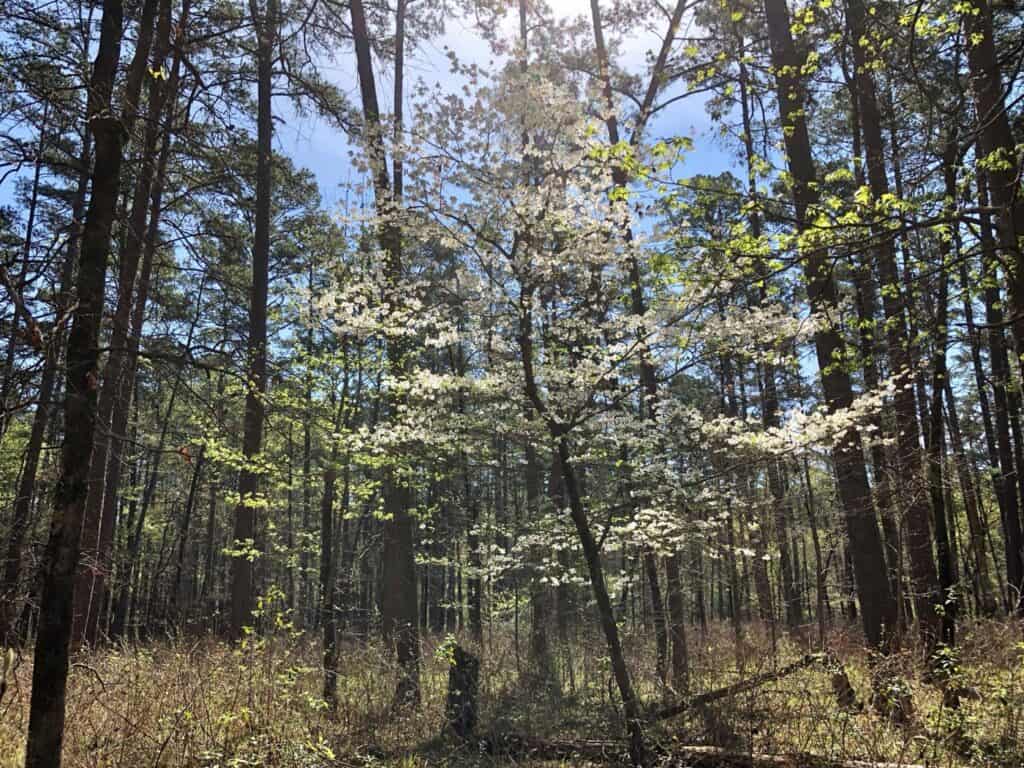
Davy Crockett National Forest is home to the red-cockaded woodpecker, a rare bird of Southern pine forests that lives in the Ratcliff Lake area. The forest’s population is part of the bird’s federal recovery plan, with a goal of 330 active family groups.
- Birders counted more than 20 species at Ratcliff Lake in May 2025, and visitors often see woodpeckers, deer and squirrels
- Coyotes call at night around Neches Bluff, so keep pets close
- Feral hogs root up stretches of the 4C Trail
- Big Slough’s hardwoods include white oak, red oak, hickory, cherrybark oak and sweetgum, which turn color in late fall
Best Time to Visit
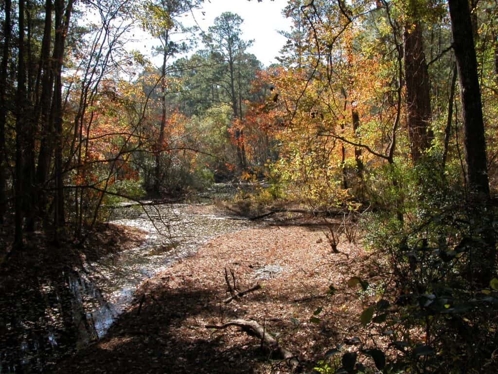
The best time to visit Davy Crockett National Forest is late October through April, when the woods are cooler and the bugs are few. Summer brings heat, mosquitoes and the busiest weekends at Ratcliff Lake.
- Fall: hardwoods turn red and gold late in the season. Deer season starts, with archery from October 3 and the general season from November 7
- Winter: the fewest bugs and the quietest campgrounds. A January 2026 thru-hiker saw no mosquitoes, though showers at Ratcliff Lake ran lukewarm
- Spring: dogwoods bloom and the woods green up. The Forest Service ran prescribed burns around Ratcliff Lake in spring 2026, and spring weekends crowd the beach
- Summer: swimming season, but heat cuts hikes short, bathhouses get stuffy, and the swim area can turn weedy and low by late summer
What Visitors Say
Visitors rate Davy Crockett National Forest highly. Its main Google listing averages 4.75 stars across 51 reviews from November 2024 to October 2026 (4.6 lifetime from about 1,270), and Ratcliff Lake’s two listings average 4.8 across 83 reviews. Most written reviews are about Ratcliff Lake.
- Quiet: roomy, shaded sites and near-empty campgrounds on weekdays and in the off-season
- Clean showers: Ratcliff Lake’s restrooms get frequent praise for hot showers and supplies. The camp-loop bathhouses are dated, though, and stuffy in summer
- Holiday crowds: loud music on Labor Day and spring weekends at the beach and campground
- Hookups: outer Dogwood Loop sites have water and electric, the inner loop electric only. A few campers found dead power boxes
- First-come sites: one camper found most tent sites marked reserved on a Friday but empty until Saturday. On a January holiday weekend, first-come electric sites were still open
- Cell signal: poor at Ratcliff Lake, per one camper. AT&T worked at Neches Bluff
Getting There

Ratcliff Lake, where most visits start, sits on State Highway 7 between Ratcliff and Kennard, about 20 minutes east of Crockett and 30 minutes west of Lufkin. From Houston, take I-69/US 59 north to Lufkin, then Highway 103 west and Highway 7 west to the entrance.
- From Crockett: Highway 7 east 15 miles, then left on the entrance road
- From Lufkin: Highway 103 west 16 miles to Highway 7, west 12 more miles, then right at the entrance
Drive times to Ratcliff Lake:
- Houston: about 2 hours 50 minutes (147 miles)
- Dallas: about 3 hours 15 minutes (172 miles)
- Austin: about 3 hours 45 minutes (196 miles)
- San Antonio: about 5 hours (267 miles)
A Few Things to Know Before Driving Out
- Much of the forest is reached on dirt Forest Service roads. Reviewers report washouts, a sandy hill and fallen trees near Neches Bluff
- Storm-recovery road work on Forest Service Road 544 has run since June 2026; expect haul trucks and delays
- Holly Bluff Boat Ramp is closed through December 31, 2027
- ATVs and off-road vehicles aren’t allowed anywhere on the forest. The Motor Vehicle Use Map shows which roads are open to which vehicles
- The ranger district office on Forest Service Road 574 in Kennard sells maps and passes, Monday to Friday, 8 a.m. to 4:30 p.m.
Know Before You Go
Fees and passes: most of the forest is free to enter. Ratcliff Lake charges $5 per vehicle per day for day use (an older Forest Service page still says $3), $15 a night for a campsite and $20 with electric. The $30 National Forests and Grasslands in Texas Annual Day-Use Pass covers Ratcliff Lake day use; the America the Beautiful annual pass isn’t accepted there. Senior and Access pass holders get 50% off day use at developed swim areas and boat launches. Confirm current fees on the Forest Service Ratcliff Lake page.
Booking: campsites book on Recreation.gov, about 6 months ahead. Group shelters need a reservation at least 2 days ahead. There is no day pass to reserve.
Hours: Ratcliff Lake day use runs 6 a.m. to 10 p.m., and developed recreation areas close overnight except to campers. The ranger office is open Monday to Friday, 8 a.m. to 4:30 p.m., closed on federal holidays. Veterans Day, November 11, 2026, is a fee-free day.
- Dogs: on a leash of 6 feet or less, or crated. No pets in the swim area except service animals. Horses aren’t allowed at Ratcliff Lake
- Fires: no fires within 300 feet of a trail or developed parking area, no fireworks, and no fires or charcoal grills anywhere on the forest when the county has a burn ban. Check Houston and Trinity counties with the Texas A&M Forest Service
- Swimming: only in the Ratcliff Lake swim area, in daylight, and never within 100 feet of a boat ramp
- Water: drinking water only at Ratcliff Lake. None on the 4C, at Neches Bluff or at White Rock Horse Camp
- What to bring: plenty of water, insect repellent, an offline map, toilet paper and trash bags for primitive sites, and bright clothing in hunting season. Pack out all trash
Check conditions first: trail closures, road work and fire rules change. Read the Forest Service alerts page and call the Davy Crockett Ranger District at (936) 655-2299 before heading out.
Nearby Parks
Davy Crockett National Forest sits in the East Texas Piney Woods, with more parks within two hours. Mission Tejas State Park, at the north end of the forest about 25 minutes from Ratcliff Lake, has 8.5 miles of trails and 17 campsites.
- Ratcliff Lake Recreation Area (inside the forest): the full guide to the lake, campground loops and swim area
- Huntsville State Park (about 1 hour 40 minutes): pine forest around 210-acre Lake Raven, with 2 cabins and 26 screened shelters
- Lake Livingston State Park (about 1 hour 35 minutes): campsites and 10 screened shelters on the southeastern shore of Lake Livingston
- Sam Houston National Forest (about 1 hour 50 minutes): the national forest closest to Houston, home of the Lone Star Hiking Trail
More options: Parks Near Houston.
FAQ
Is Davy Crockett National Forest a national park?
No. It’s a national forest run by the USDA Forest Service, and there is no Davy Crockett National Park. Unlike a national park, most of the forest has no entrance gate or fee, and it allows hunting and dispersed camping.
What county is Davy Crockett National Forest in?
It covers parts of Houston and Trinity counties in East Texas. The ranger district office is in Kennard, and the nearest larger towns are Crockett and Lufkin.
Are there cabins in Davy Crockett National Forest?
No. The forest has campsites only, and nearby Mission Tejas State Park has no cabins either. The closest state park cabins are at Huntsville State Park, about 1 hour 40 minutes away, and hotels are in Crockett and Lufkin.
Can visitors camp anywhere in the forest?
Not anywhere. Dispersed camping is allowed within 150 feet of roads marked for it on the Motor Vehicle Use Map, for up to 14 days in any 30, and some roads allow it only in fall and winter.
Can visitors ride ATVs in Davy Crockett National Forest?
No. ATVs and off-road vehicles aren’t allowed anywhere on the forest. The only designated off-highway vehicle trail in Texas’s national forests is in Sam Houston National Forest.
Sources and Official Links
Facts in this guide were last checked in October 2026 against these sources.
- Davy Crockett National Forest (USDA Forest Service)
- Davy Crockett Ranger District office
- Ratcliff Lake Recreation Area (Forest Service)
- Ratcliff Lake campground reservations (Recreation.gov)
- Four C National Recreation Trail and its trail map (PDF)
- Davy Crockett National Forest alerts
- Hunting on the National Forests and Grasslands in Texas
- Motor Vehicle Use Map 2025 (PDF)
- Passes and fees
- Big Slough Wilderness
- Neches Bluff Overlook
- Piney Creek Horse Trail
- Occupancy and use order and fire order
- Alabama Creek WMA (TPWD)
- Mission Tejas State Park (TPWD)
Featured photo: USDA Forest Service, Wikimedia Commons (Public Domain)
Get More Texas Outdoor Adventure Tips
Subscribe to get more places to explore in the great outdoors of Texas. We’ll never share your email. Unsubscribe any time.