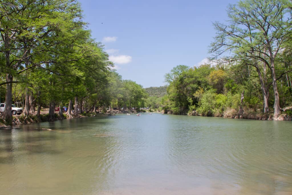
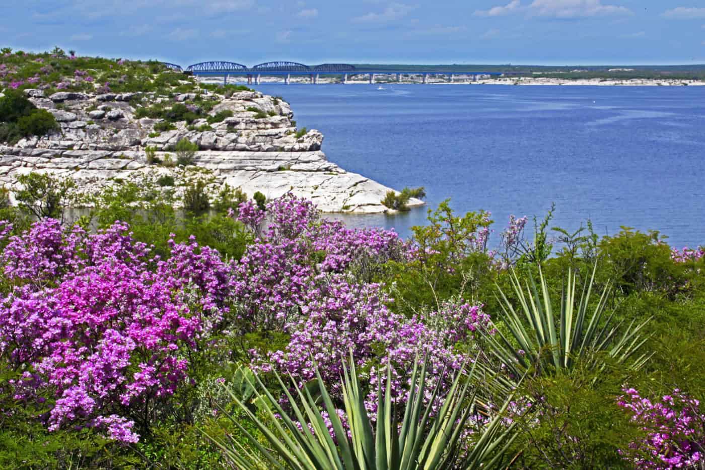
Amistad National Recreation Area covers the US side of Lake Amistad, the reservoir on the Rio Grande near Del Rio in Val Verde County, about 3 hours west of San Antonio. It’s best for boating, bass fishing, swimming and cheap lakeside camping. The lake is still about 52 feet below full, so check which boat ramps are open before towing a boat out.
At a Glance
- Drive time: about 3 hrs from San Antonio, 4½ from Austin
- Entry fee: none; boats pay a lake use pass ($4 a day)
- Hours: open 24 hrs; visitor center 8 a.m. to 4:30 p.m.
- Reservations: none; group sites on Recreation.gov
- Dogs: yes, 6-ft leash; not on docks, ramps or caves
- Swimming: yes, outside harbors; no lifeguards
- Camping: 5 first-come campgrounds, $6 to $10
- Best time: spring and fall
- Low lake: 52 ft below full; most ramps closed (Oct 2026)
- Cell signal: good near Del Rio, weak on the water
- Run by: National Park Service, (830) 775-7491
On This Page
- Lake Amistad Water Level and Boat Ramps
- Boating and Paddling
- Fishing
- Swimming and Scuba Diving
- Panther Cave and Rock Art
- Hiking
- Camping
- Best Time to Visit
- What Visitors Say
- Getting There
- Know Before You Go
- Nearby Parks
- FAQ
- Sources and Official Links
Lake Amistad Water Level and Boat Ramps
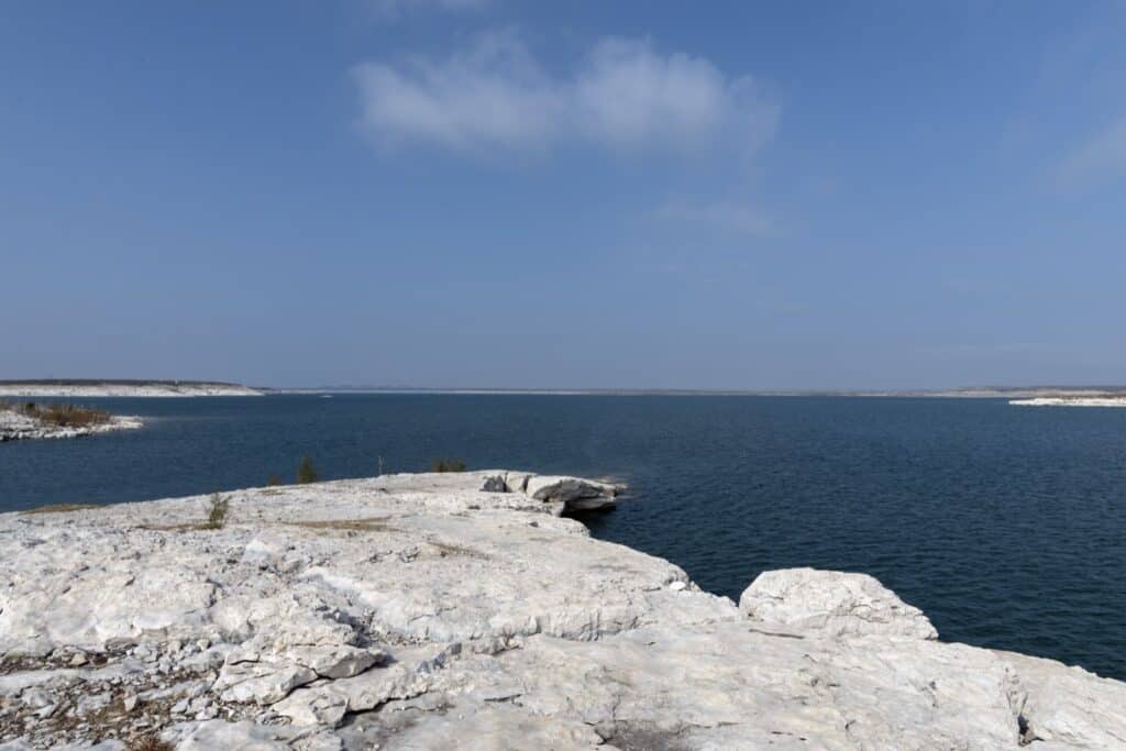
Lake Amistad is low but rising. On October 31, 2026, it stood at 1,064.78 feet, about 52 feet below its 1,117-foot conservation pool (the normal full level), according to the Texas Water Development Board (TWDB).
The reservoir fills the canyons where the Rio Grande, Devils and Pecos rivers meet. It hasn’t been full since April 2011 and hit a record low of 1,047.15 feet in July 2024, per the National Park Service (NPS).
- This year: the lake fell to 1,047.17 feet in June 2026, then rose about 18 feet by October 31. A year earlier it stood at 1,057.64 feet
- Percent full: 48% of the Texas share (TWDB); 29% of the whole reservoir (International Boundary and Water Commission)
- Live levels: TWDB Amistad page, the National Weather Service gauge (AMIT2) and the NPS current conditions page
Which Boat Ramps Are Open
Only three ramps were open on the NPS conditions page updated October 15, 2026. Ramp status changes quickly with the lake level.
- Open: Rough Canyon Marina low-water ramp (right side closed), Spur 406 and the Spur 454 low-water ramp. (both old roadways into the lake, not true ramps)
- Closed: Black Brush Point, Box Canyon, Pecos River, Southwinds, 277 North, 277 South, and the high-water ramps at Rough Canyon and Spur 454
- Diablo East: listed as “closed to all uses.” Its marina cove, Scuba Cove and walkway are also closed for unsafe docks and unstable ground
- Kayaks and canoes: closed ramps can still be used for small, light boats carried to the water, unless signs say otherwise
Boating and Paddling
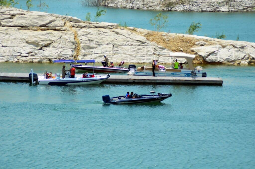
Boating is the main way to see Amistad National Recreation Area. The park runs 74 miles up the Rio Grande, 25 miles up the Devils River and 14 miles up the Pecos River.
The Lake Use Pass
- Who needs it: every motorboat of any size, even one with only a trolling motor, and any non-motorized boat 14 feet or longer
- Who doesn’t: canoes, kayaks, rowboats and rubber rafts of any length, plus other paddled boats under 14 feet
- Cost: $4 for 1 day, $10 for 3 days, $50 a year. Holders of the federal Senior or Access pass pay half
- Where to buy: fee machines or the visitor center, card only; annual passes also on Pay.gov
Rules on the Water
- The border: buoys mark the US-Mexico line. Mexico expects boaters on its side to carry passports
- Wind: winds average 15 to 20 mph and often reach 20 to 30 mph, NPS says. Clean, drain and dry boats every time
- Fuel and rentals: Southwinds Marina sells the lake’s only marine gas to the public. Rough Canyon Marina has no gas or rental boats. NPS lists motorboat rentals on its guides and rentals page
Paddling Routes
NPS suggests seven unmarked paddle routes, from 3.2 miles (Spur 454 to San Pedro Creek) to a 16-mile round trip to Indian Springs. Devils River paddlers take out at Rough Canyon. Rangers can’t help paddlers stranded on the Mexican side.
Fishing
Lake Amistad is known for largemouth bass, along with white bass, striped bass and channel and blue catfish. A Texas fishing license covers US waters; a Mexican license is required past the boundary buoys, where Mexican limits apply.
- From shore: allowed anywhere outside harbors and swim areas. Fishing docks are listed at Governors Landing, Rough Canyon and Black Brush
- Closed to fishing: the Diablo East, Southwinds and Rough Canyon harbors inside the no-wake buoys, and Scuba Cove
- Fish cleaning stations: Diablo East, Pecos and Rough Canyon
- Guides: NPS lists five authorized fishing guides on its guides and rentals page
- Fish advisories: no Texas health advisory names Lake Amistad as of October 2026
The Texas Parks and Wildlife Department (TPWD) Amistad fishing page has current regulations.
Swimming and Scuba Diving
Swimming is allowed almost anywhere in Amistad National Recreation Area, except harbors, mooring areas, within 200 feet of fishing docks and posted closed areas. There are no lifeguards, and NPS recommends life jackets.
- Where people swim: NPS calls the shore by Governors Landing Campground one of the most popular swimming spots. Visitors in 2026 describe clean, warm water there, down a steep walk
- Diablo East: the Diablo East area is listed as closed, and visitors in 2025 and 2026 said its old swim area no longer reached the water
- Getting to the water: at this lake level, the shore is often a long, rocky walk below the parking areas. Bring water shoes and a wagon for gear
- Water temperature: low 50s °F in winter to the mid-80s °F in summer
Scuba divers come for the clarity. NPS says visibility reaches 40 to 50 feet from November to April and drops to 10 feet or less from May to October. Scuba Cove at Diablo East is closed as of October 2026; the NPS diving page has dive rules.
Panther Cave and Rock Art
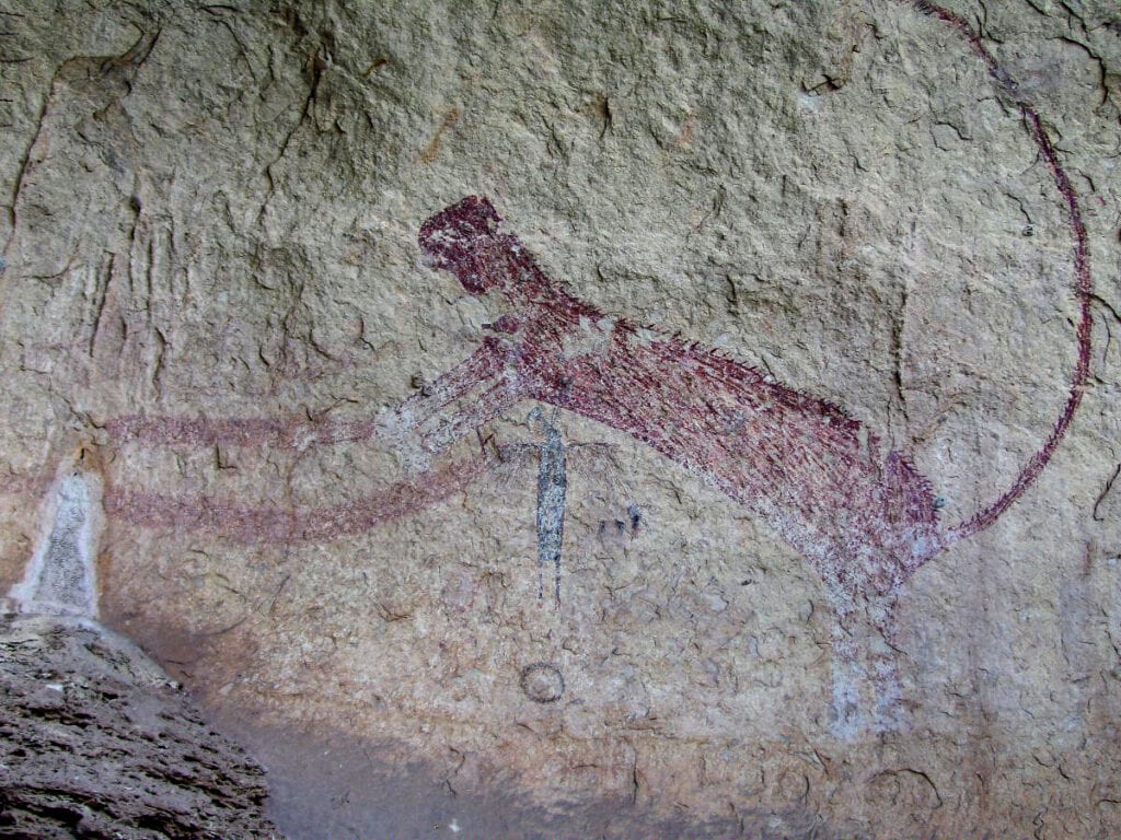
Panther Cave and Parida Cave are the two Lower Pecos pictograph sites in Amistad National Recreation Area open to the public, and both are reached only by boat. Panther Cave is named for a large red painted panther on its back wall.
- Getting there: paddlers usually launch at the Pecos River ramp, which was closed to trailered boats in October 2026. Panther Cave is about 8 miles from that launch, for strong paddlers only
- Low water: both sites have closed at times when the upper lake was too low to reach safely, and the Parida dock may be pulled. Call the visitor center at (830) 775-7491 before going
- Rules: 2-hour dock limit, stay on the trails, no camping or dogs. Other caves and rock shelters are mostly closed
- By land: Seminole Canyon State Park, about 35 minutes west, runs guided tours to Fate Bell Shelter Wednesday to Sunday ($8 ages 13 and up, $5 ages 5 to 12, plus the $4 park entry). Reserve ahead
Most other rock art in the region is on private land. The NPS rock art page explains how to visit.
Hiking
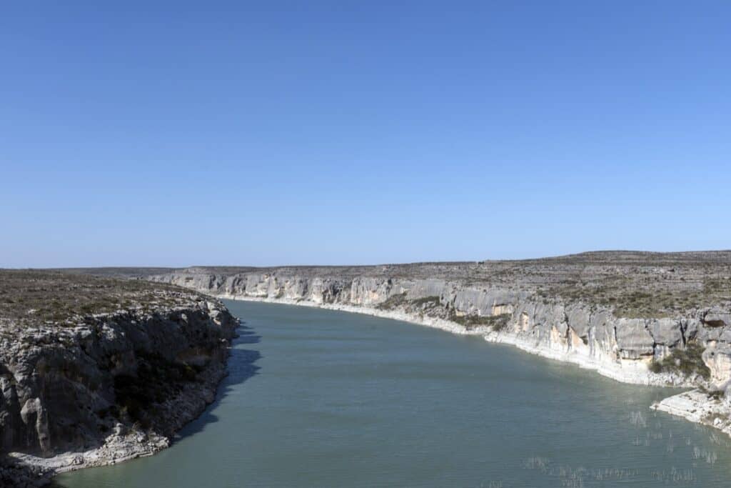
Hiking at Amistad National Recreation Area is short and scenic rather than a main draw. The longest trails are across the Devils River arm, and most loops run 1.5 miles or less.
| Trail | Miles | Where |
|---|---|---|
| Diablo East Blue Trail Loop | about 1 | Diablo East, from the RV dump station |
| Diablo East Green Trail Loop | 0.5 | Diablo East, north end of the lower lot |
| Diablo East Nature Trail (lake views) | 0.3 | Diablo East, north end of the upper lot |
| Sunrise Trail (benches, lake views) | about 1.5 | 9685 US 90 West to Spur 454 |
| Figueroa Trail System (longest trails) | not listed | near the Rock Quarry group site |
| Pecos nature trail (river and cliff views) | short | Pecos Day Use Area |
- Hunting season: the Figueroa trails sit in a hunt area. Use caution from September 1 to February 28
- Diablo East: with the area listed as closed, call the visitor center before planning on these loops
- Water: NPS says to carry 1 gallon per person per day. Shade is scarce
- Maps: Diablo East, Sunrise Trail and Figueroa (PDFs)
For canyon views without a hike, the US 90 roadside overlook at the Pecos River High Bridge is the most-reviewed stop in the area.
Camping
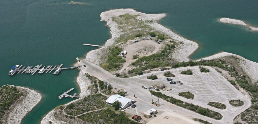
Amistad National Recreation Area has five campgrounds, all first-come, first-served, at $6 to $10 a night. Every site has a covered picnic table and a grill, but there are no hookups or showers, and only Governors Landing has drinking water.
Campsite Types
- Governors Landing (15 sites, $10): the only campground with water spigots, near the most popular swimming shore. 28-foot vehicle limit. Visitors mention close sites and US 90 truck noise
- San Pedro (about 40 sites, $6): the best fit for big RVs, reached by a 1¼-mile gravel road. No water. Level dirt sites under shelters, quiet but dusty or muddy, visitors say
- 277 North (17 sites, $6): no water; level sites with shaded tables, grills and trash bins
- Spur 406 (6 sites, $6): no water; can close for high water
- Rough Canyon (4 sites, $6): no water at the sites; restrooms and running water at the nearby ranger station. Small, so it fills
- Group sites: Rock Quarry (up to 35 people), San Pedro (up to 75) and 277 North (up to 35), $35 to $155, on Recreation.gov 3 to 180 days ahead
- Shoreline camping: allowed on the lakeshore, mostly reached by boat, at least ¼ mile from roads, ramps and campgrounds, up to 28 nights a year; pack out human waste
Reservations and Camp Rules
- Booking: no reservations. Claim a site and pay at the machine within 30 minutes, card only
- Busy times: NPS says campgrounds rarely fill except on holiday weekends. (visitors describe a loud Easter weekend)
- Limits: 8 people, 1 RV and 3 vehicles per site; 14 nights in a row and 60 nights a year
- Fires: grills, fire rings or stoves only; Val Verde County burn bans apply. Quiet hours 10 p.m. to 6 a.m.
- RV dump: a dump station with potable water sits on the road to the Diablo East ramp, for paying campers
Best Time to Visit
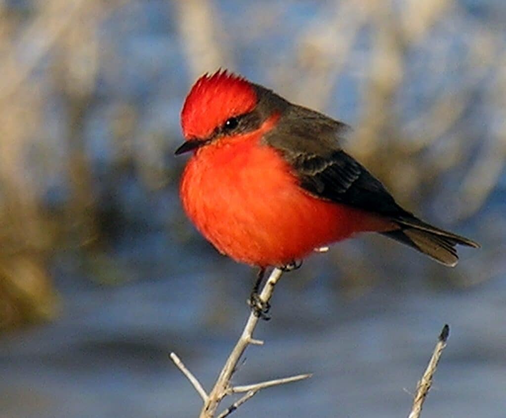
Spring and fall are the best times to visit Amistad National Recreation Area. Summer highs average 97 °F in July and August, and winter is mild but windy.
- Spring (March to May): warm days before the summer heat. Visitors report cold, windy spells in March
- Summer (June to August): hot, with the warmest water for swimming. About 80% of the rain falls April to October, often as storms that flood fast
- Fall (September to November): the water stays warm into fall. Hunting season starts September 1 in the five hunt areas
- Winter (December to February): lows around 41 °F in January, clear water for divers and the quietest campgrounds. Camp hosts may be on duty at Governors Landing and Rough Canyon
What Visitors Say
Amistad National Recreation Area averages 4.6 stars across 226 Google reviews of 26 park listings from November 2024 to October 2026. Clear blue water and cheap campsites earn the praise; low water and closed ramps draw the complaints.
- Clear water: the most repeated compliment is how blue and clear the lake is for Texas, even when low
- Low water: about 17 reviews mention it, and many describe a long, steep, rocky walk to the shore. Several say the park is best seen from a boat
- Campgrounds: praised as cheap, quiet and clean, with spotless vault toilets. No showers, and highway noise at Governors Landing
- Closures: a September 2026 visitor found most areas closed and couldn’t swim or camp as planned, and asked NPS to post closures more clearly
- Visitor center: rangers get repeated praise for local advice
- Border: drivers heading north pass a Border Patrol checkpoint. One camper at Spur 406 felt uneasy in 2025; NPS says incidents involving visitors are very rare
Getting There
The Amistad visitor center is at 10477 US 90 West, about 7 miles west of Del Rio. From San Antonio, take US 90 west about 160 miles through Uvalde and Del Rio. Rough Canyon is about 23 miles northwest of Del Rio off US 277/377.
Drive times to the visitor center:
- Del Rio: about 15 minutes
- San Antonio: about 3 hours 10 minutes
- Austin: about 4 hours 35 minutes
- Houston: about 6 hours 30 minutes
- Dallas: about 7 hours 50 minutes
A few things to know before driving out:
- The park is spread out: Spur 406 is about 13 miles west of the visitor center on US 90, and Rough Canyon is off US 277/377 north of Del Rio. Download offline maps
- Supplies: buy gas, ice and groceries in Del Rio. Visitors say Google Maps gets confused inside the park
- Border Patrol: visitors report a checkpoint when driving north
- Amistad Dam: the road across the dam is a port of entry into Mexico. A passport or other citizenship document is needed to cross any part of it
Know Before You Go
Amistad National Recreation Area has few services and changes with the lake level. These fees, rules and tips matter most.
- Fees and passes: no entrance fee. Boats pay the lake use pass ($4 a day, $10 for 3 days, $50 a year), campsites cost $6 to $10, and a season hunting permit is $40. The park is cashless. Confirm current fees on the NPS fees page
- Booking: standard campsites are first-come; only group sites book on Recreation.gov
- Hours: the park is open 24 hours, year-round. The visitor center is open 8 a.m. to 4:30 p.m. daily and closed Thanksgiving, Christmas and New Year’s Day.
- Dogs: allowed on a leash up to 6 feet long, but not at caves, rock art sites, marinas, docks or ramps (except going straight to a boat).
- Water and shade: drinking water only at Governors Landing and the Pecos Day Use Area. Bring plenty, plus sun protection
- Hunting: five hunt areas are open September 1, 2026, to February 28, 2027, bow and shotgun only
- Rules: no glass anywhere, no alcohol in park buildings, no drones without written approval, no ATVs or off-road driving
- Cell signal: NPS says coverage is good in the busy areas, but phones near the lake can switch to Mexican networks and charge roaming fees
- Emergencies: call 911. For non-emergencies, call the Val Verde County Sheriff at (830) 774-7513 and ask for a park ranger
- What to bring: water shoes, a wagon for gear, extra water, a card for fees and offline maps
Check conditions first: ramps, swim areas and rock art sites open and close with the lake level. Check the NPS current conditions page or call (830) 775-7491 before driving out.
Nearby Parks
These TrekTexas guides cover parks within a few hours of Amistad National Recreation Area (road miles from the visitor center).
- Devils River State Natural Area: about 64 miles north (Del Norte Unit). The Devils River feeds Lake Amistad, and paddlers finish at Rough Canyon
- Kickapoo Cavern State Park: about 66 miles east, with cave tours and summer bat flights
- Garner State Park: about 110 miles east, on the Frio River
- Lost Maples State Natural Area: about 145 miles northeast, known for fall color
- More parks west of the city: Parks Near San Antonio
FAQ
Is Lake Amistad drying up?
No, but it’s low. The lake was about 52 feet below full on October 31, 2026, up about 7 feet from a year earlier after the record low of July 2024.
Can people swim in Lake Amistad?
Yes. Swimming is allowed outside harbors, mooring areas, posted areas and the 200 feet around fishing docks. There are no lifeguards.
Are there alligators in Lake Amistad?
No NPS page checked for this guide mentions alligators at Amistad, and none of the 226 Google reviews from the last two years do. Ask the visitor center about current wildlife.
Is Lake Amistad safe to visit?
NPS says incidents involving visitors are very rare, and visitors mention rangers on patrol. The bigger risks are wind on the water, heat, and swimming with no lifeguards.
Sources and Official Links
Facts in this guide were last checked in October 2026 against these sources.
- Amistad National Recreation Area and basic information (NPS)
- Current conditions and boat ramp status (NPS)
- Fees and passes, camping and boating (NPS)
- Fishing, paddling, scuba diving and hiking (NPS)
- Rock art, pets, hunting and safety (NPS)
- Superintendent’s Compendium (NPS park rules)
- Directions and weather (NPS)
- Amistad Reservoir levels (Texas Water Development Board)
- Amistad group campsites (Recreation.gov)
- Seminole Canyon State Park and Amistad fishing (Texas Parks and Wildlife)
Featured photo: National Park Service, NPGallery (Public domain), August 2016
Get More Texas Outdoor Adventure Tips
Subscribe to get more places to explore in the great outdoors of Texas. We’ll never share your email. Unsubscribe any time.